Parque Nacional Perito Moreno is with approximately 1200 visitors one of the remotes national park in Argentina. Perito (master) Francisco Moreno explored the geography, fauna and flora of Patagonia at the turn of the 19th / 20th century. Not only this park is named after him, also a small town and the famous glacier (see article Cerro Torre, Cerro Fitz Roy and Glaciar Perito Moreno).
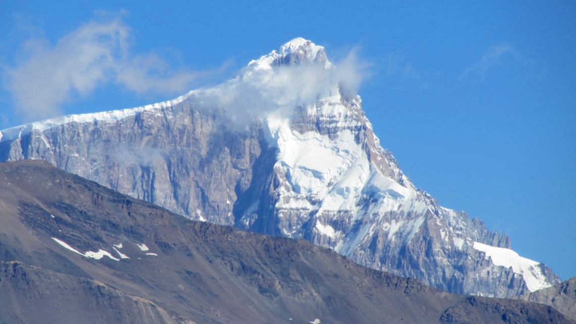
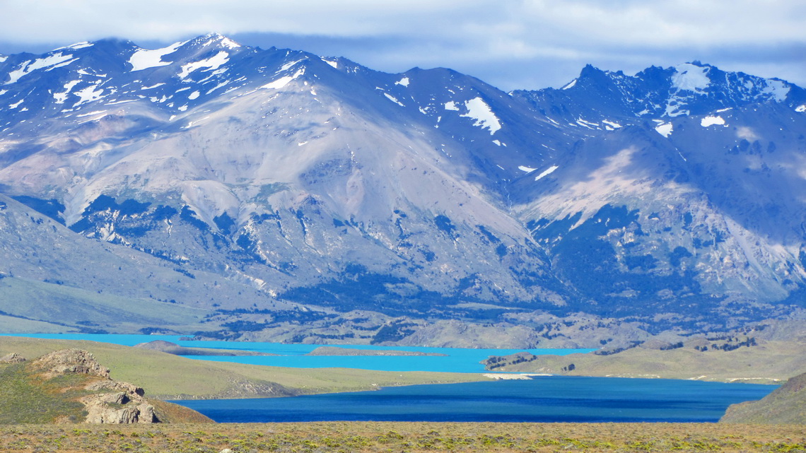
This park is a rough and windswept area decorated with cobalt and aquamarine blue lakes, snowy peaks and glaciers. It is located on the southeast side of Cerro San Lorenzo, which is with 3706 meters sea level one of the highest mountains in Patagonia. The entrance to the Perito Moreno national park is free of charge as well as two basic campsites.
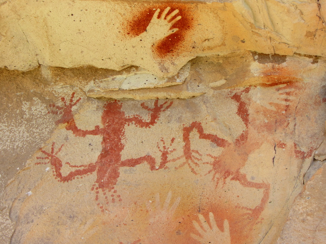
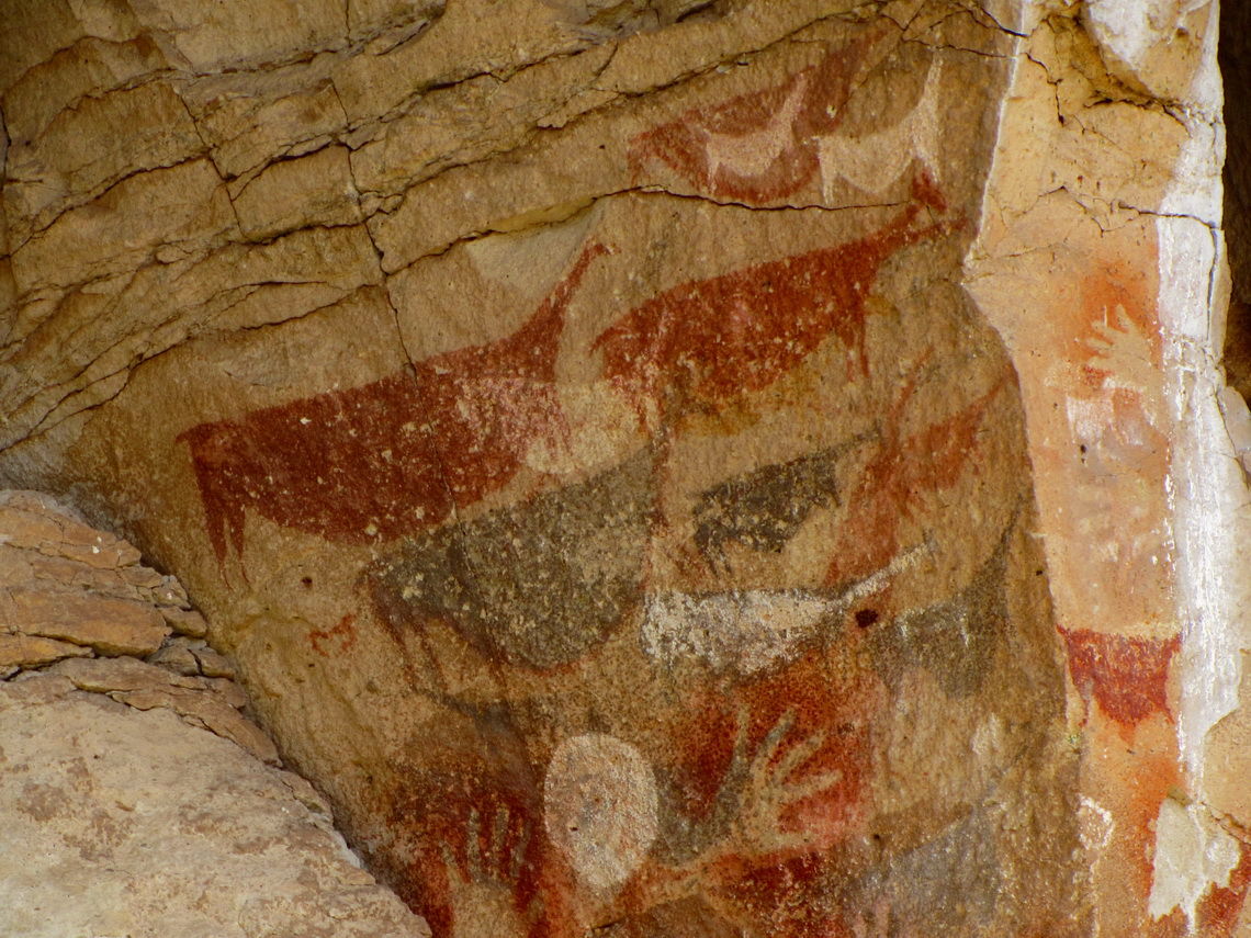
200km northeast is the cave Cueva de los Manos, which had been declared as world heritage by the UNESCO in 1999. There are fabulous and more than 9000 years old paintings, mainly of left hands.
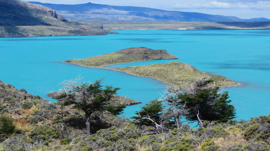
We had some stormy weather, when we came to the lake Lago Burmeister in the Perito Moreno national park on January 10th 2012. The campsite is very nice in forest directly on the lake. Fortunately it provides good wind protection. We walked half the way on the north shore of the lake and we enjoyed the nature besides the hefty wind.
When we came back we found some rhubarb and peppermint. Marion cooked a delicious compote which we ate at dinner with Brigitte and Lukas from Switzerland. Fresh peppermint tea was a reasonable alternate tea in the next weeks.
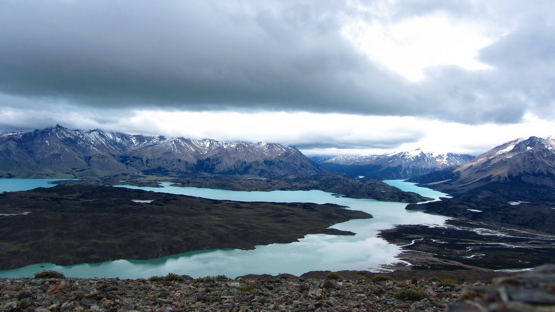
1434 meters high Cerro Leon - Lion's peak (GPS coordinates: S47° 46.745' W72° 08.039') provides stunning views to the lakes, peaks and glaciers. Unfortunately most of the mountains were in clouds. Its trail starts at S47° 45.971' W72° 06.994'.Our track is included in the GPS coordinates file of Argentina.
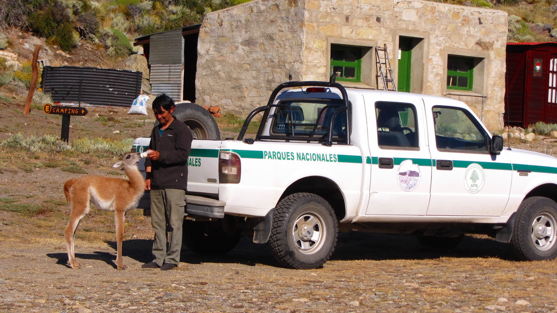
In the evening the weather became sunny and we found a strange young animal at the ranger station El Rincon. Its mother disappeared six weeks ago, when it was born. Thus the ranger looked after the baby.
On the next morning we drove to the lake Lago Belgrano. There is a narrow isthmus to a peninsula. This isthmus divides not only the water but also the color of it. We crossed the peninsula and circled back via the south shore. It is a pleasant and remote hike in an outstanding and marvelous environment of about 6 hours. Tommy and Alfred swam few second in the lake, very fresh!
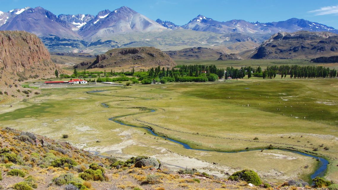
The cave Cueva de los Manos is a must to see in Argentina. They are located on a steep side of the green valley Valle de los Pinturas within the deserted pampa. Valle de los Pintures means valley of the paintings and there are approximately 800 pictures done by the natives 9000 years ago. The majority shows left hands, plotted negativly in red, orange or black.
January 15th 2012, we crossed the Andes via the first possible southern route to the Carretera Austral in Chile over the Paso de Rodofo Roballos.

For more pictures, please click here For a map of our itineraries, click here
To download the GPS coordinates file of Argentina, click here





I clicked submit my comment didn't appear. Grrrr...
well I'm not writing all that over again. Anyways, just wanted to say superb blog!